

Rand McNally Folded Map Set: Virginia & West Virginia - Detailed Road Maps With Driving Times & Mileage
$ 43.50
Direct from vendor: Usually ships within 3 business days.
Offers & perks
You may also like


Product Details
Web ID: 842525Don't rely solely on your phone's spotty signal when exploring Virginia and West Virginia!

This trusted Rand McNally folded map set gives you reliable, detailed navigation right in your hands.

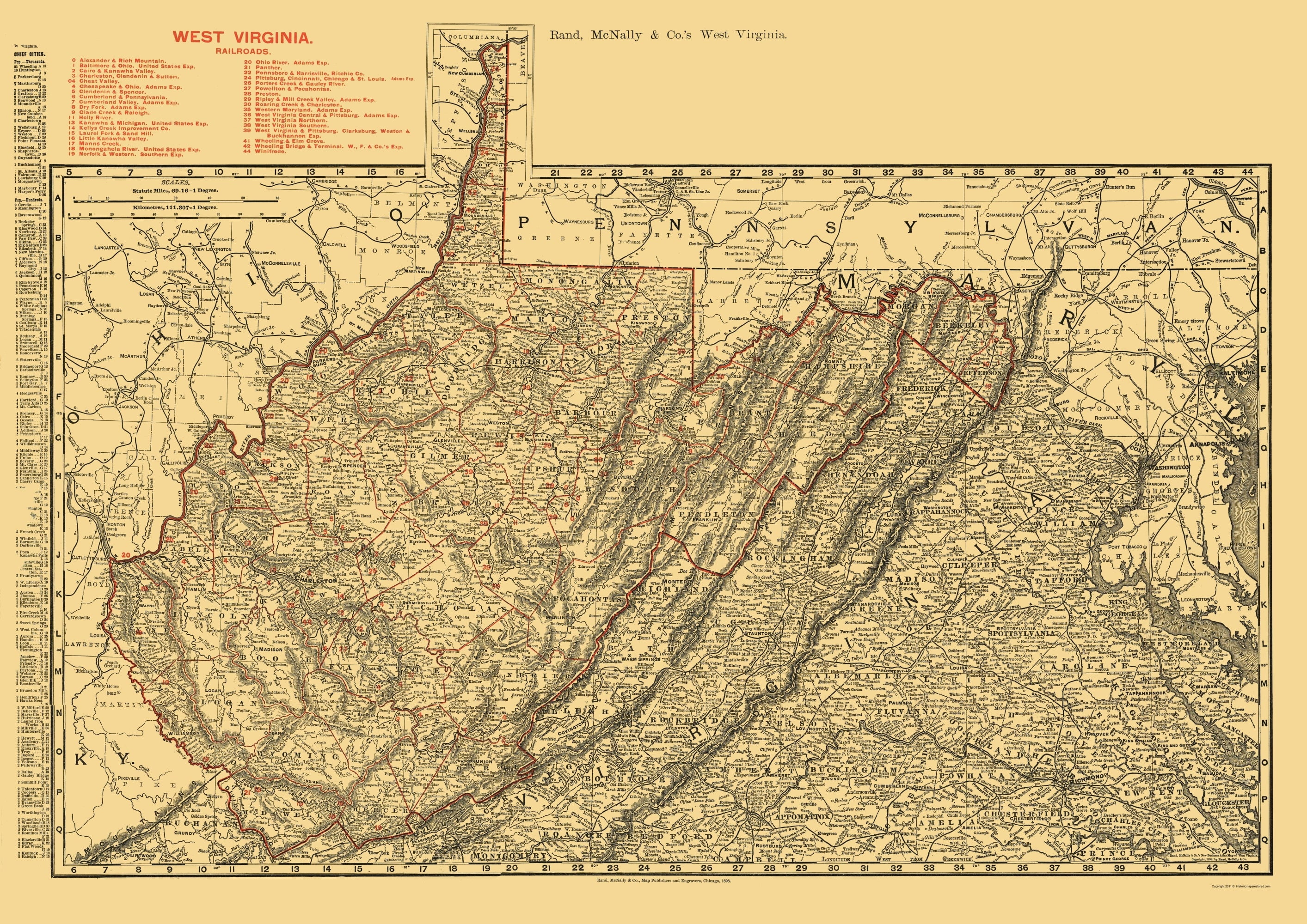
Each map is packed with all the info you need: clearly marked interstates, US highways, state roads, and even county routes.

You also get useful extras like a driving times map between major cities, a state mileage chart, climate data, and visitor center locations.

The easy-to-read legend makes it simple to figure out where you are and where you're going.

Whether you're planning a scenic road trip through the Blue Ridge Mountains, visiting historical sites, or just need a reliable backup, these accurate, high-quality maps are an essential travel companion.

Keep one in your glove box – you'll be glad you did.


Discover more options